“I come, I see, I scan2BIM!”
Scan to BIM is our ultimate service available to our clients!
Authorised Distributor
Authorised Distributor
Authorised Reseller
Authorised Reseller

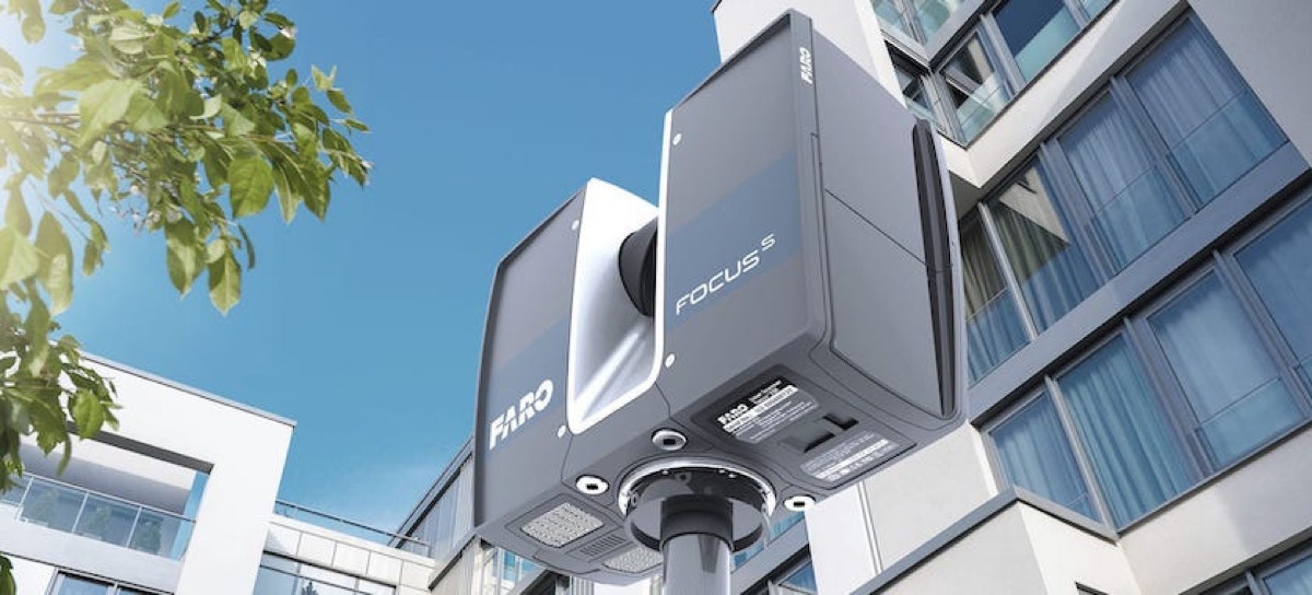
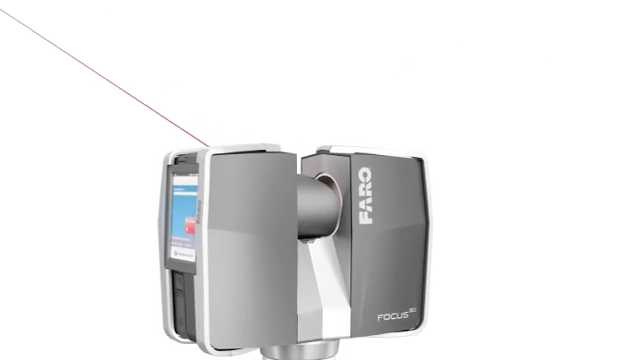
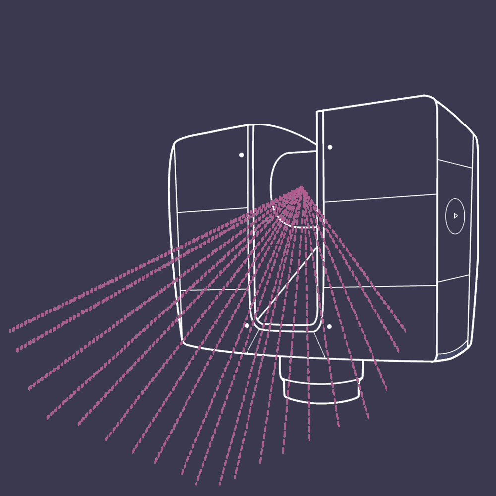
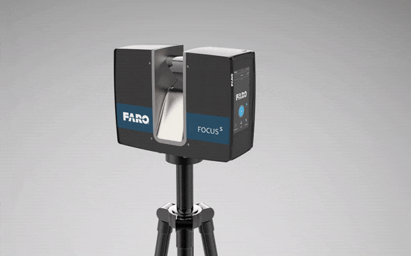
Our Top-guns for detail and precise terrestrial 3D scanning are FARO Focus (S350) and Trimble X7. They are meant mainly, but not limited to, indoor scanning of places like shopping malls, railway stations, townhouses, units in strata buildings, old structures for preservation purpose, statues, high-rise buildings, coastal area, stockpiles, natural and/or artificial slopes and anything which requires to be digitally documented in 3-dimensions.
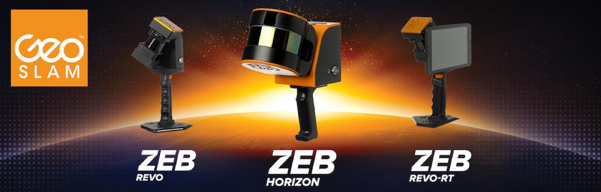
When forestry, tree survey and rural/remote area topographic survey at medium to small scale come in place, we use a hand-held scanner, ZEB REVO from GeoSLAM, which can provide positional accuracy at 3 centimeter level and colour 3D point cloud. This hand-held type scanner has been proved to be very useful for indoor mapping and BIM making.
When we need to scan objects like statues, street furniture, human bodies, mechanical parts, and similar things that require sub-millimetre precision, our hand-held scanners, GoScan 3D and HandyScan700, will come in place. Forensic scanning which requires point cloud up to 2mm millimetre accuracy, we will employ our new FARO FreeStyle3D.
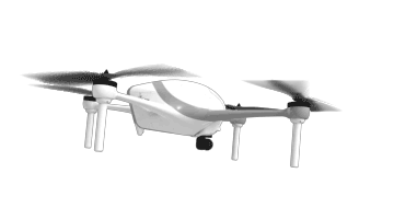
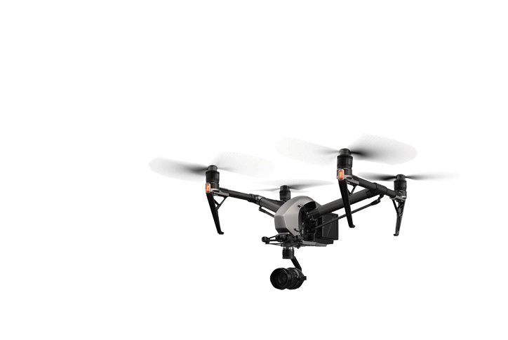
We have DJI Inspire 1 Pro and Phantom 3D for UAV Photogrammetry; Trimble R12i GNSS Receiver for geodetic and/or RTK positioning, Trimble V10 imaging rover for terrestrial photogrammetry. Trimble Business Centre and Trimble RealWorks will be the core engines for processing the data.
FARO SCENE and PointSense (previously Kubit), PointCAB, GeoMagic, Autodesk Revit are also used for data-processing, editing, filtering, BIM creation and 3D-Modelling after field scanning. Final product data-files in various formats can be output with ease.
Most industries can benefit from our services including:- Antiquities and Monuments, Archaeology, Architecture, Building Information Management (BIM), Crime Scene Investigation, Traffic Accident Investigation, Disaster Investigation, Crime Scene Investigation, Real Estate, Large Scale Laser Projection Work, Civil Engineering, Monitoring, Bridge and Tunnel Construction, Reverse Engineering, Rehabilitation, and anything you can imagine!
“Most industries can benefit from our services including:- Antiquities and Monuments, Archaeology, Architecture, Building Information Management (BIM), Crime Scene Investigation, Traffic Accident Investigation, Disaster Investigation, Crime Scene Investigation, Real Estate, Large Scale Laser Projection Work, Civil Engineering, Monitoring, Bridge and Tunnel Construction, Reverse Engineering, Rehabilitation, and anything you can imagine!”


We have been providing professional and high precision 3D scanning services to clients since 2010. We helped the Hong Kong Airport Authority to carry out an as-built 3D-scan of the whole Terminal 1 for building a BIM model for future renovation and design; we scanned a large portion of Causeway Bay including the circular foot-bridge for the making of the movie “Ghost In A Shell”; we have done numerous 3D documentation work including, but not limited to pagodas, temples, historical buildings and archaeological sites.
Capturing the measurements of a large object or building with conventional documentation methods can take days or weeks, and even then the data might contain errors or missing details. But 3D Laser Scanners create accurate, complete and photorealistic 3D images of any environment or object in just a few minutes. We are authorised distributor of FARO Focus laser scanner and GeoSLAM REVO/Horizon SLAM-based scanners.


Many of our customers have BIM models as their final goal. With our 3D-scanning systems and services, we provide our clients solutions to achieve this. We have completed outstanding BIM projects for two 400Kv power plants of China Light & Power in Lung Kwu Tan (Castle Peak and Black Point).
With our state-of-the-art imaging systems and fast global capture service, we provide our customers with the very latest street level data to help drive their business forward. We use NCTech which can offer 360° street-level data capture services across multiple industry sectors, providing high resolution geo-referenced imagery, LiDAR and environmental datasets at any scale.


“There is only one rule for the industrialist and that is: make the best quality goods possible at the lowest cost possible, paying the highest wages possible.”
Henry Ford


All Rights Reserved © 2022
0
